
1400
1539
1611
1711
1746
1879
1900
Post War
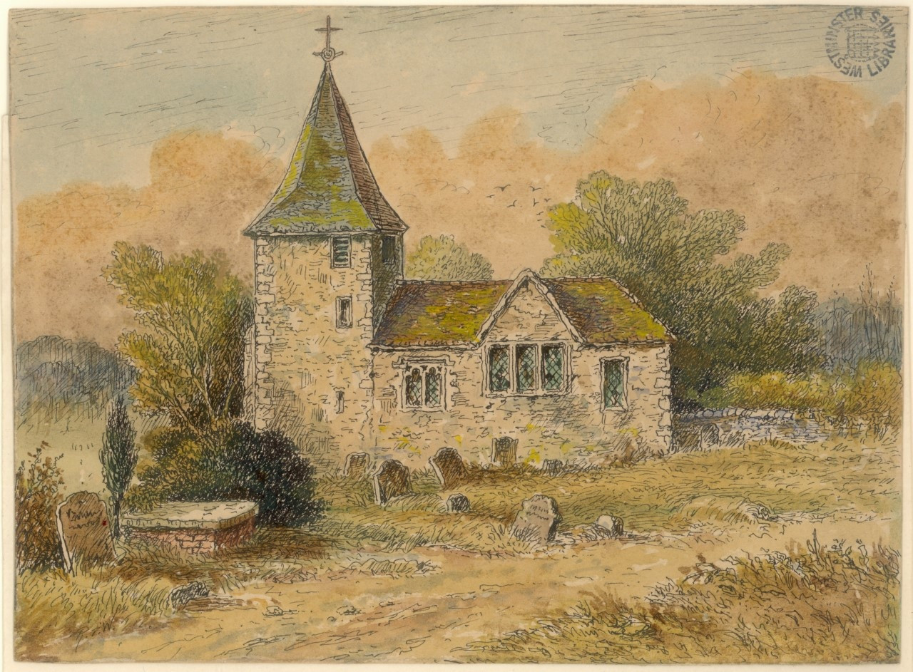
The parish church of St Mary was built around 1400 on Marylebone High Street south of its present site
1400
In 1400, the old Tyburn church, which was located in a dangerous spot just off Oxford Street, was relocated to a more salubrious location at the top of what is now Marylebone High Street. The new church was named St Mary’s. The area soon became known as St Mary’s on the Bourne, then St Mary-la-Bourne, then finally St Marylebone, although the rather fluid standards of historical spelling saw it rendered as Marybone, Mary-le-burn, Mary-la-bonne, Mariburn and even Marrowbone.
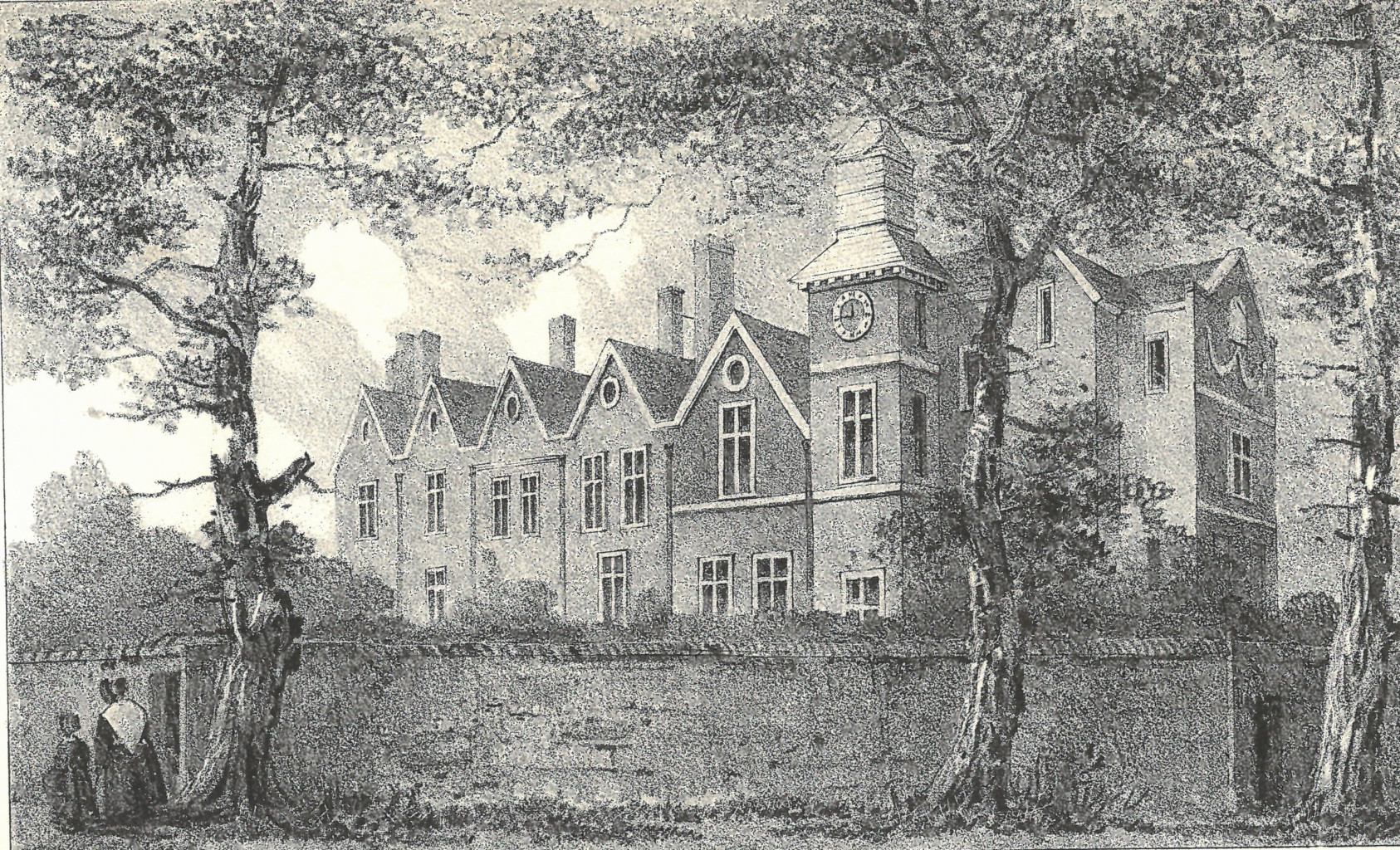
The manor house which the king developed into a hunting lodge was later a school, shown here in 1790 shortly before demolition
1539
The managing of the manor of Tyburn passed through a succession of aristocratic hands, but ultimately remained a possession of Barking Abbey. As such it was confiscated by Henry VIII when he dissolved the monasteries in 1539. He created a Royal Park (now Regent's Park), and redeveloped the manor house as a royal hunting lodge, where 55 Marylebone High Street now stands.
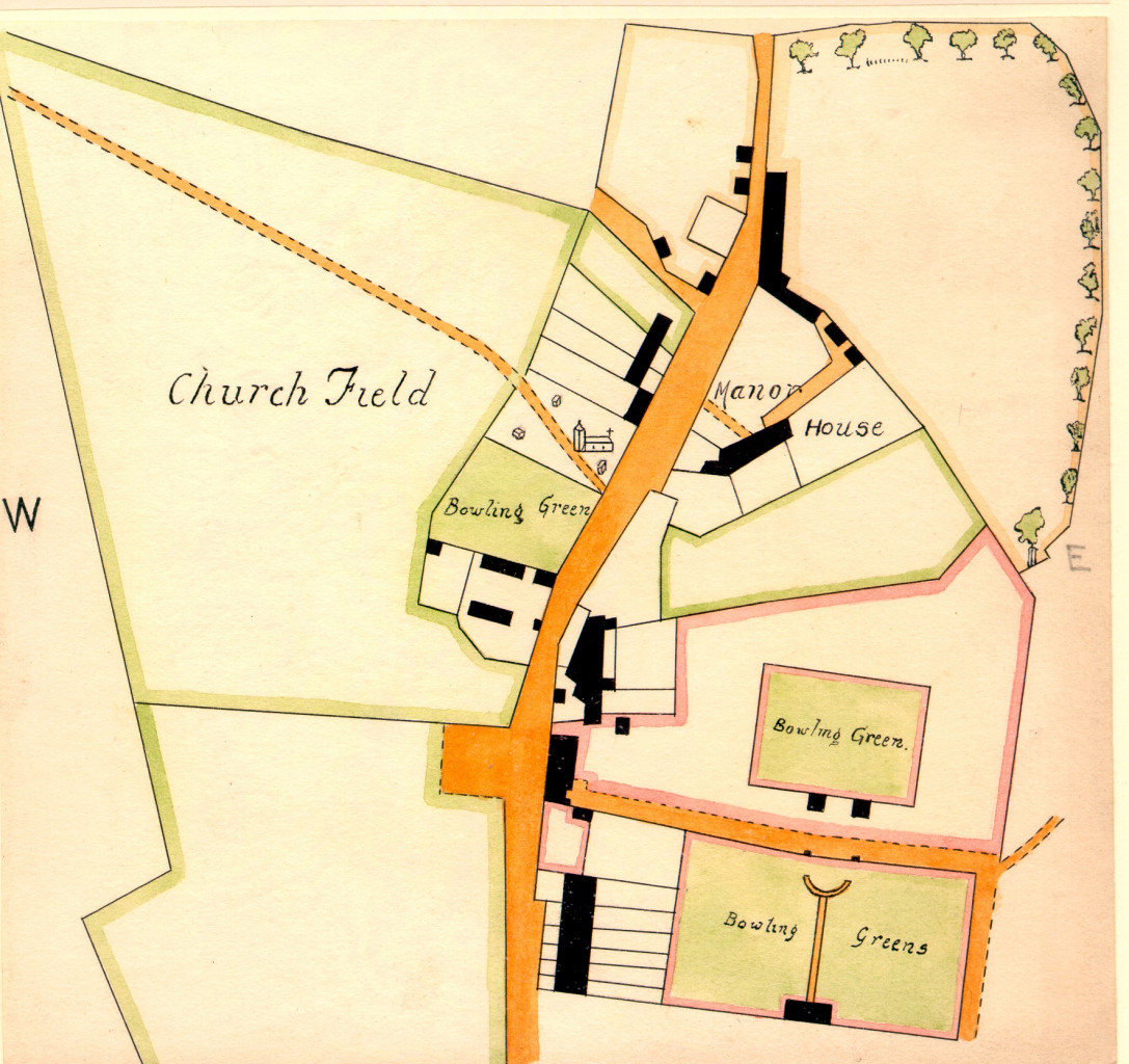
The earliest depiction of Marylebone village shown on an estate map of 1708. (By permission of City of Westminster Archive Centre)
1611
The remainder of the manor was leased to the Forsett family who eventually purchased the freehold from James I in 1611. Forsett’s descendant John Austen sold some of his properties to raise cash for his political ambitions. Probably with this in mind he commissioned the earliest known map of the Marylebone estate in 1708.
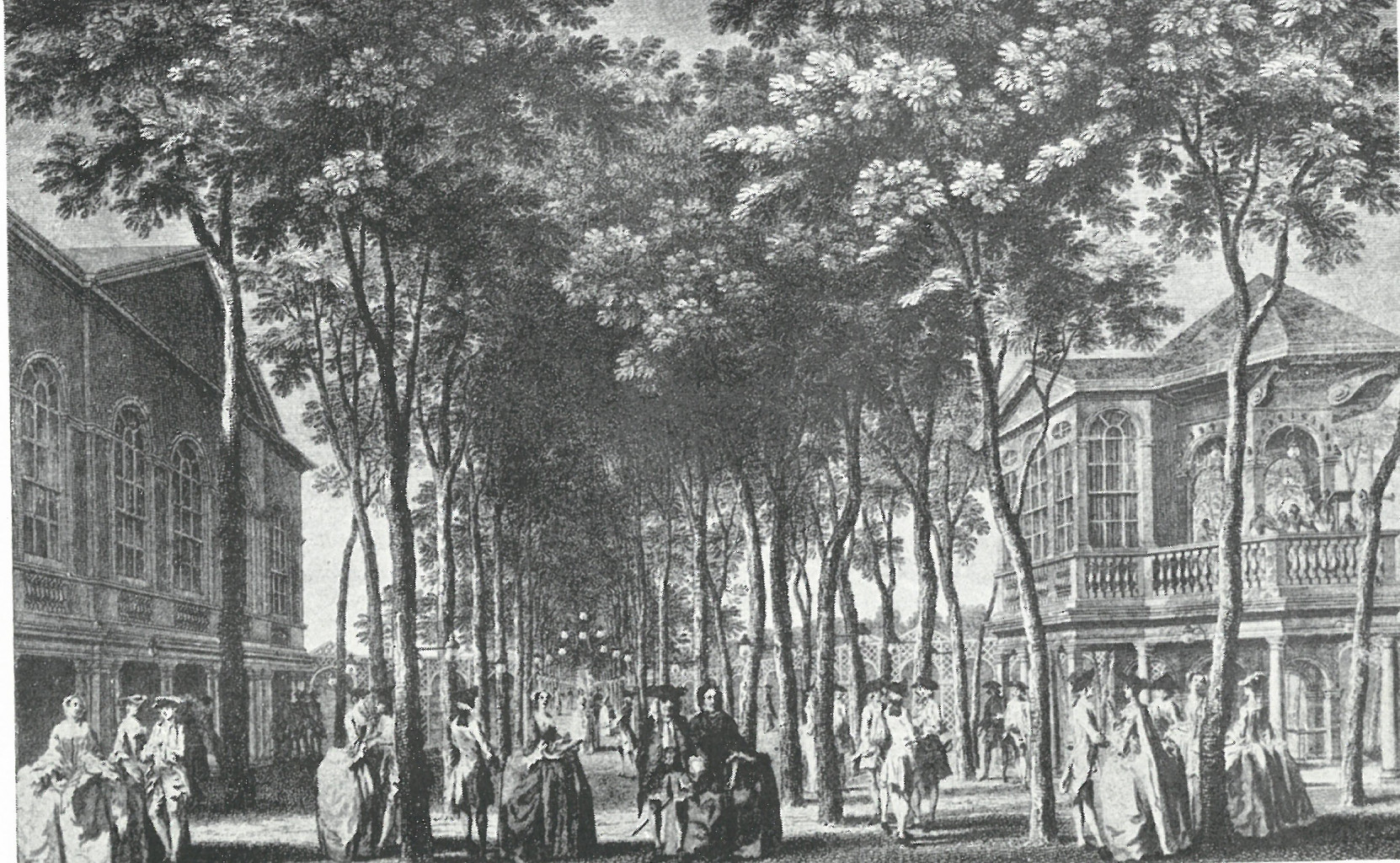
The Orchestra and Grand Walk in Marylebone Gardens, c1755
1711
In 1711, John Holles, Duke of Newcastle, paid £17,000 for what was called the Marylebone estate, probably with a view to developing it. At the time it was still a quiet country village with a small number of houses dotted along the high street. The Duke died a few months after his purchase and the estate passed to his daughter, Henrietta Cavendish-Holles who two years later married Edward Harley, 2nd Earl of Oxford. As London expanded rapidly westwards, Lord and Lady Oxford commissioned the architect John Prince to draw up a plan to convert their fields into a fashionable city estate, with Cavendish Square at its focal point. The plan was approved in 1719, but progress was initially very slow, not helped by the financial crash caused by the South Sea Bubble in 1720. It accelerated under Lord and Lady Oxford’s daughter, Margaret Cavendish Harley, wife of the second Duke of Portland. Building continued on what was then known as the Portland Estate, and today’s tall Georgian houses began to emerge along the wide roads of Harley Street, Portland Place and Wimpole Street.
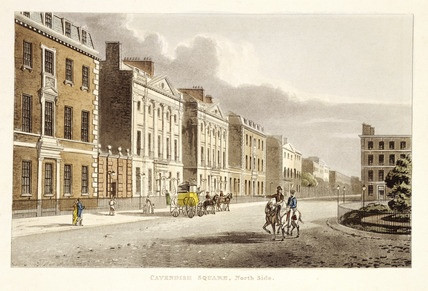
Cavendish Square in 1813
1746
By 1746, building had only reached as far north as Wigmore Street and Mortimer Street, but the rapid pace of development meant that by 1799 virtually the whole area from Oxford Street to Marylebone Road was covered with houses. Numerous architects and builders placed their stamp upon this burgeoning quarter, the most celebrated being the Adam brothers, who were responsible for Mansfield Street and the overall design and layout of Portland Place, which architect John Nash later called “the most magnificent street in London”.
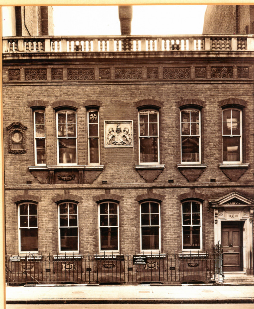
The original Howard de Walden estate office built at 23 Queen Anne Street in 1882
1879
The Portland Estate flourished for five generations until 1879 when the death of the childless fifth Duke saw the land pass to his sister, Lucy Joan Bentinck, widow of the 6th Baron Howard de Walden. The Portland Estate became The Howard de Walden Estate, and the development of the area continued apace. Most of the buildings on the high street today date from around 1900 when the area was given a major facelift.
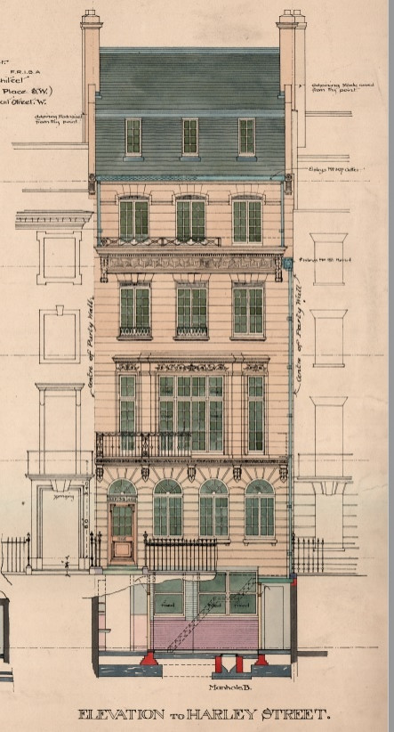
Elevation of 52 Harley Street built for Dr Haldin Davis in 1925
1900
The late 19th century was a defining period for Harley Street, as doctors began to set up consulting rooms in large numbers, drawn to the area by its attractive building stock and close proximity to several hospitals. There were around 20 doctors in the area in 1860, 80 by 1900, almost 200 by 1914 and 1,500 by 1948. The Harley Street Health District remains synonymous with healthcare.

Marylebone High Street c1970
Post War
The past hundred years have seen the area continue to evolve. Marylebone did begin to stagnate somewhat in the second half of the 20th century, losing some of the lustre of its heyday, but this all began to change in the 1990s, thanks to the inspired management of Howard de Walden, which understood that the creation of a distinctive retail environment would have a positive impact on every aspect of Marylebone life. As more and more high streets became clones of each other, Marylebone opted instead for character, quality and distinctiveness. This strategy has been carried through into an equally progressive approach to office, residential and medical developments. As a result, the area has slowly evolved into the highly prosperous, culturally vibrant and hugely popular urban village that we see today. And it will continue to evolve—carefully and thoughtfully—in the years to come.
